The Big Grass Fire has officially surpassed the 500,000-acre threshold, marking one of the most destructive wildfire events in the Pacific Northwest’s recent history. Straddling the rugged border regions of Oregon and Idaho, the blaze has triggered a massive interagency response, drawing specialized fire crews from California and Washington to bolster local containment efforts. As the fire continues to churn through high-desert terrain, regional authorities are grappling with an urgent humanitarian and economic crisis, as the flames threaten vital ranching operations and displace significant livestock populations.
Key Highlights
- Unprecedented Scale: The Big Grass Fire has consumed more than 500,000 acres of high-desert vegetation and ranch land across the Oregon-Idaho border.
- Multi-State Coalition: Firefighting agencies from California and Washington have deployed advanced suppression crews to support local Oregon and Idaho teams.
- Economic Threat: Ranching operations and livestock assets are currently in the direct path of the fire, leading to emergency evacuations of cattle and regional economic concerns.
- Containment Challenges: Extreme terrain and shifting wind patterns have hampered traditional containment lines, requiring reliance on aerial suppression and strategic back-burning.
The Anatomy of the Big Grass Fire
The Big Grass Fire is not merely a singular event but a complex hydrological and meteorological phenomenon that has pushed emergency services to their operational limits. Unlike forest fires, which rely on timber density, this massive grass-dominated inferno travels at high velocities, often driven by intense surface winds typical of the high-desert plains. The rapid spread—crossing from Eastern Oregon into the Idaho panhandle—has forced the Bureau of Land Management (BLM) and the National Interagency Fire Center (NIFC) to declare the incident a priority, effectively nationalizing the resource response.
Oregon and Idaho Under Siege
The geographic scope of this fire covers a vast, semi-arid expanse that is critical to the regional agricultural ecosystem. Local authorities report that the blaze began in a remote area of Oregon before jumping county lines into Idaho. The speed of the fire’s expansion caught local emergency management off guard, leading to urgent evacuation orders for rural communities and ranching enclaves. Communication infrastructure in these remote sectors has been intermittent, forcing incident commanders to rely on satellite-based tactical networks to coordinate ground crews.
The Multi-State Logistics Coalition
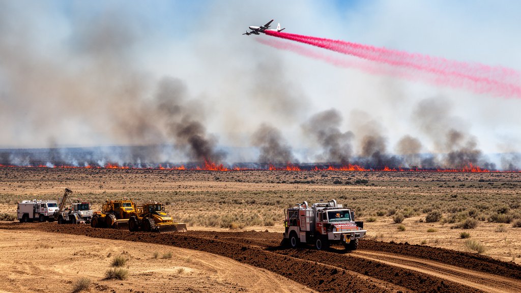
The arrival of reinforcements from California and Washington represents a strategic escalation in the regional firefighting posture. These units, known for their specific expertise in wide-area grass suppression and incident command management, are working under a unified command structure. This coalition approach is essential; the fire’s perimeter is so vast that local resources, even with full mobilization, are mathematically incapable of maintaining a containment line. The incoming crews are utilizing heavy machinery to create firebreaks—strips of land stripped of vegetation to starve the fire—while aerial tankers dump fire retardant to protect the most vulnerable ranching infrastructure.
Ranching Operations and Economic Fallout
Beyond the immediate physical threat, the Big Grass Fire represents a catastrophic potential blow to the regional agricultural economy. The area affected is home to several historic ranching operations that serve as the backbone of the local rural economy. Livestock displacement has been the primary concern; ranchers are working frantically to move thousands of head of cattle away from the fire’s path. The economic impact is twofold: the immediate loss of livestock and grazing infrastructure, such as fencing and water systems, and the long-term degradation of rangeland health, which may take years to recover.
Historical Precedents in High Desert Wildfires
When examining the Big Grass Fire through a historical lens, one can see a clear trend of increasing fire intensity in the West. Decades of fire suppression policies have led to a build-up of invasive, highly flammable grasses, such as cheatgrass, which creates a continuous fuel bed across the high desert. Historically, these fires were contained to smaller geographies, but modern climatic variables—specifically prolonged heatwaves and decreased humidity—have effectively turned millions of acres into a tinderbox. The Big Grass Fire is arguably the culmination of these shifting ecological factors.
Climate and Vegetation Dynamics
Experts analyzing the fire point to a significant shift in the vegetation composition of the Oregon-Idaho border. The proliferation of non-native, fine-fuel grasses has radically altered the fire regime. These fuels ignite rapidly and spread horizontally with incredible speed, making the fire behavior difficult to predict with traditional models. Furthermore, the lack of late-season precipitation has left the soil moisture levels at record lows, exacerbating the flammability of the terrain. This combination of fuel type and arid climate creates a ‘mega-fire’ scenario that traditional containment strategies were not originally designed to mitigate.
Strategic Future Resilience
In the wake of this disaster, policy discussions regarding future resilience are already taking shape. Experts are advocating for a more aggressive approach to land management, including the strategic use of prescribed burns during cooler months to break up the continuity of fuel loads. Additionally, there is a push for increased investment in rural firefighting infrastructure, including automated early-warning detection systems and improved water-access points for aerial tankers. Ensuring that future coalitions have the technology and intelligence to act before a fire hits the 500,000-acre threshold will be the primary metric of success for future mitigation strategies.
FAQ: People Also Ask
1. What is the current containment status of the Big Grass Fire?
As of the latest briefings, containment is fluctuating as shifting winds create new hotspots along the perimeter. Command centers are prioritizing the protection of structures over pure acreage containment.
2. How are livestock ranchers managing the evacuation of animals?
Local ranchers are collaborating with the High Desert Ranchers Association and state agencies to establish temporary grazing zones and livestock triage centers outside the evacuation perimeter.
3. Why did crews from California and Washington get involved?
Under the Emergency Management Assistance Compact (EMAC), states share resources during disasters that exceed local and state capacity. This coalition ensures the specialized personnel needed for a fire of this magnitude are available.
4. Is there an estimated date for full containment?
Incident commanders have not released a fixed containment date due to the unpredictable nature of the weather and the scale of the blaze. Updates are provided every 12 hours via regional emergency portals.