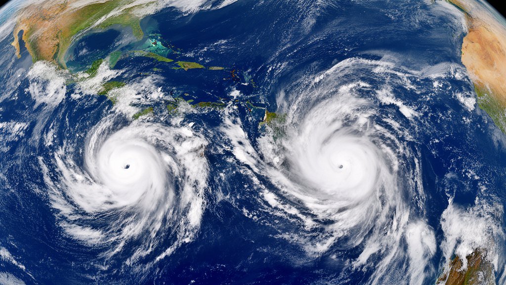
Tropical Storm Nolo is rapidly closing in on the Hawaiian archipelago, with meteorological models indicating a high probability of intensification into a hurricane by nightfall. Simultaneously, Hurricane Polo continues to track along Mexico’s Pacific coastline, generating severe weather conditions that have prompted widespread concern among regional authorities. As both systems track through the Pacific basin, emergency management agencies in both regions have initiated urgent response protocols. In Hawaii, the immediate measures include state-wide school closures to protect students and staff, while Mexican coastal authorities are bracing for significant rainfall and potential storm surges as Hurricane Polo moves in parallel to the shoreline.
Key Highlights:
- Tropical Storm Nolo is projected to undergo rapid intensification, reaching hurricane-strength sustained winds by nightfall, requiring immediate public vigilance.
- The Hawaii Emergency Management Agency (HI-EMA) has activated emergency protocols, resulting in immediate, wide-scale school closures across the affected islands.
- Hurricane Polo is actively impacting the Mexican Pacific coast, delivering heavy precipitation and high winds that threaten local infrastructure and coastal communities.
- Meteorologists are monitoring the unusual convergence of these two cyclonic systems, which presents unique challenges for disaster management and resource allocation.
The Meteorological Convergence: A Dual-Front Weather Crisis
The Nolo Trajectory and Hawaii’s Defensive Posture
As Tropical Storm Nolo approaches Hawaii, the primary concern for the Hawaii Emergency Management Agency (HI-EMA) is the unpredictable nature of rapid intensification. The system, which has been steadily tracking across the Pacific, is currently drawing energy from exceptionally warm ocean temperatures. Forecasters from the Central Pacific Hurricane Center have noted that Nolo’s path places it in a prime corridor for strength gain, with the current trajectory putting it on a collision course with the islands before nightfall.
In response, Governor-level emergency decrees have been activated, not only to facilitate school closures but also to streamline evacuation logistics. The state’s preparedness strategy focuses heavily on the island topography, where narrow roadways and limited exit routes make early action critical. Residents are being advised to secure property, clear drainage paths, and finalize emergency kits as the window for safe preparation narrows. The decision to shutter schools is a proactive measure intended to keep roads clear for emergency vehicle access and to ensure that children remain in safe environments during the storm’s initial onset.
Hurricane Polo: Mexico’s Pacific Coast Under Siege
While Hawaii prepares for the arrival of Nolo, Mexico’s Pacific coastline is already experiencing the adverse effects of Hurricane Polo. This system, characterized by a sprawling cloud field, is responsible for localized flash flooding, mudslides in elevated coastal regions, and dangerous rip currents. The Mexican National Meteorological Service (SMN) has maintained a high-alert status for coastal municipalities, issuing warnings about the accumulation of rainfall in short durations, which poses a severe risk to infrastructure in vulnerable, low-lying regions.
Unlike the island-based threat facing Hawaii, the risk in Mexico is characterized by a long-duration event. Polo’s movement along the coast means that communities will experience extended exposure to high winds and rain bands. Local civil protection authorities are coordinating the deployment of temporary shelters, particularly for residents living in traditional structures that may not withstand heavy, sustained precipitation. The challenge here is the geographic spread; the storm’s reach covers hundreds of miles of coastline, requiring a decentralized response effort that relies heavily on local coordination centers.
Scientific Perspectives on Concurrent Pacific Cyclones
The occurrence of simultaneous cyclones in the Pacific—Nolo in the central basin and Polo in the eastern—serves as a stark reminder of the Pacific’s role as an engine for extreme weather. Meteorologists look at the interaction of these systems as a complex fluid dynamics problem. While these storms are separated by thousands of miles, their combined effect on atmospheric pressure and moisture distribution across the Pacific Ocean is significant. Research into these “binary” or near-binary storm events often highlights the impact of sea surface temperatures (SSTs), which have trended higher in recent seasons.
These higher temperatures provide the fuel necessary for rapid intensification, transforming a tropical depression into a major hurricane in a matter of hours. The scientific community is currently evaluating how these conditions influence the track of such systems. For the public, the takeaway is clear: the reliance on historical weather patterns is decreasing in utility, and the standard for preparation must now account for the increasing frequency and intensity of these Pacific events.
Infrastructure and Long-Term Economic Resilience
Beyond the immediate threat to life and property, Hurricane Polo and Tropical Storm Nolo represent significant economic stressors. For Hawaii, the tourism-dependent economy faces an immediate disruption, with flight cancellations and resort closures becoming inevitable as the storm draws nearer. The cost of such events extends beyond the cleanup; it involves the long-term impact on supply chains. Similarly, in Mexico, the agricultural sectors situated along the coast are bracing for damage to crops, which could have cascading effects on local markets.
Government agencies are increasingly turning their attention to “resilience infrastructure”—projects designed to mitigate the damage before it happens. This includes the hardening of power grids to prevent widespread outages and the implementation of advanced flood control systems in coastal urban centers. The current dual-storm event serves as a stress test for these systems, with officials likely to conduct a comprehensive post-event analysis to refine future evacuation and response strategies.
FAQ: People Also Ask
1. Q: How do emergency agencies differentiate the threat between Hawaii and Mexico?
A: Emergency agencies prioritize based on geographic vulnerability. In Hawaii, the focus is on the isolation of the archipelago, requiring self-sufficiency and island-wide lockdowns. In Mexico, the focus is on large-scale coastal evacuations and protecting infrastructure from prolonged rain-induced flooding.
2. Q: What does ‘rapid intensification’ mean for a storm like Nolo?
A: Rapid intensification refers to an increase in a tropical cyclone’s maximum sustained winds of at least 35 mph in a 24-hour period. It signifies that the storm is successfully harnessing environmental energy, such as warm ocean water, much faster than average models predict.
3. Q: Why are school closures considered a primary emergency response?
A: School closures are a critical decision because they immediately remove hundreds of vehicles from the road, reducing traffic congestion for emergency responders. Additionally, it ensures that students are not in school facilities during the peak of the storm, which are often utilized as emergency shelters.
4. Q: How long will the effects of these storms last?
A: The duration of the impact depends on the storm’s forward speed. Hurricane Polo, tracking along the coast, will likely produce rain bands over several days. Tropical Storm Nolo’s impact on Hawaii will depend on its track: if it passes directly over the islands, the severe weather may last 12 to 24 hours, followed by a period of recovery and hazard assessment.