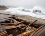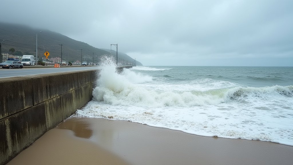
The National Weather Service (NWS) has issued an urgent series of coastal flood warnings and advisories impacting a wide swath of the California coastline, spanning from San Diego in the south through San Luis Obispo County. Meteorological experts indicate that the region is currently grappling with a severe combination of exceptionally high tides—often colloquially referred to as King Tides—and atmospheric conditions that are expected to exacerbate coastal surges. Officials have explicitly warned that the situation is likely to get worse before it gets better, as tidal peaks coincide with incoming swells, creating a volatile environment for coastal infrastructure, homes, and transit corridors.
Key Highlights
- Urgent Warnings: NWS coastal flood warnings and advisories are in effect from Sunday through Thursday, covering a significant portion of the California coastline.
- Geographic Reach: The primary impact zones include San Diego, Orange, Los Angeles, Ventura, Santa Barbara, and San Luis Obispo counties.
- Primary Hazards: Authorities are highlighting acute risks regarding coastal flooding, rapid shoreline erosion, and potential damage to public infrastructure and private property.
- Systemic Risk: The alignment of lunar cycles and oceanic swells is driving water levels to heights that test the integrity of existing sea walls and drainage systems.
Unpacking the Mechanics of the California Coastal Surge
To understand the gravity of the current situation, one must look at the convergence of meteorological and astronomical phenomena. The current event is driven by a series of high-tide cycles, intensified by long-period swells that travel thousands of miles across the Pacific Ocean. When these swells reach the California coastline, they do not dissipate uniformly. Instead, they interact with the continental shelf and the unique bathymetry of the Southern and Central California coast, amplifying the water height as it hits the shoreline.
These events are often exacerbated by climate variability, including El Niño conditions, which can elevate baseline sea levels, providing a higher “floor” from which these surges launch. As noted by the National Weather Service, the persistent nature of this weather pattern means that even a minor increase in total water level can result in a disproportionately high amount of damage. Residents and local authorities have been advised to treat these warnings with extreme caution, as the combination of high tide and incoming surge creates a “worst-case” scenario for low-lying coastal neighborhoods.
Impacted Infrastructure and Coastal Integrity
The infrastructure along the California coast is uniquely vulnerable. Much of the state’s coastal highway system, including segments of the historic Pacific Coast Highway (PCH), was built decades ago, long before the current projections for sea-level rise and extreme weather frequency were fully realized. The current surge is not merely a nuisance; it is a stress test for these aging systems.
In San Diego and Orange Counties, authorities are particularly concerned about the integrity of boardwalks and low-lying parking infrastructure that sits mere inches above the high-tide line. Similarly, in Ventura and Santa Barbara, the focus is on the protection of residential properties that sit atop coastal bluffs. Rapid shoreline erosion is a major concern here; when waves strike the base of these bluffs with extreme force, they remove the sediment that provides structural support, potentially leading to instability in the ground above.
Economic Repercussions and Local Mitigation
The economic impact of such events is often underestimated. Beyond the immediate repair costs for municipalities, there is a tangible “downtime” effect. Beaches that are heavily reliant on tourism face closures, leading to significant revenue losses for local businesses. Furthermore, local governments are forced to divert resources toward emergency flood mitigation—deploying sandbags, clearing storm drains, and stationing emergency personnel—which strains already tight municipal budgets.
Organizations such as the California Coastal Commission monitor these events to better understand long-term adaptation strategies. This current event serves as a stark reminder that as global sea levels rise, the threshold for what constitutes a “damaging” tide is becoming lower. Businesses and homeowners are increasingly being encouraged to look into long-term retrofitting, such as elevating foundations or reinforcing revetments, though such projects are often capital-intensive and subject to complex environmental regulations.
Historical Context and Future Predictions
While high-tide events are a cyclical part of coastal California life, the frequency and intensity of these surges have shifted. Historically, these events were manageable, with minor disruptions to beach access. However, recent trends analyzed by NOAA indicate that we are seeing more “nuisance flooding” days per year than in previous decades. The “likely to get worse before it gets better” sentiment expressed by officials refers to the immediate outlook for this specific week, but it also reflects a broader scientific consensus regarding the trajectory of coastal resilience.
As we move through the middle of the week, the interaction between the lunar cycle and the predicted storm swells will determine the total extent of the damage. For residents, the best course of action remains constant monitoring of NWS alerts and adherence to local emergency directives. The goal is to minimize human risk, as property damage is often the inevitable consequence of these massive, naturally occurring oceanic events.
FAQ: People Also Ask
Q: What is a King Tide, and why is it happening now?
A: A King Tide is a non-scientific term for an exceptionally high tide, caused by the alignment of the Earth, Moon, and Sun. When these gravitational forces align, they create stronger-than-average pull on the Earth’s oceans. This event is occurring now due to the specific lunar phase in conjunction with seasonal ocean patterns.
Q: Should I avoid visiting the beach during these alerts?
A: Yes. The National Weather Service strongly advises staying off the beach and away from rocky jetties or seawalls. The unpredictable nature of the surging water can easily sweep people off their feet or trap them between cliffs and the rising tide.
Q: Which specific counties are the most at risk?
A: The current flood warnings are focused on San Diego, Orange, Los Angeles, Ventura, Santa Barbara, and San Luis Obispo counties. These areas have dense coastal development that is highly exposed to tidal flooding.
Q: How does this differ from a typical storm surge?
A: A typical storm surge is driven primarily by wind and low barometric pressure. While this event may involve wind, it is primarily driven by astronomical high tides. When high tides are combined with storm-generated swells, the cumulative height of the water is significantly higher than either event would cause individually.