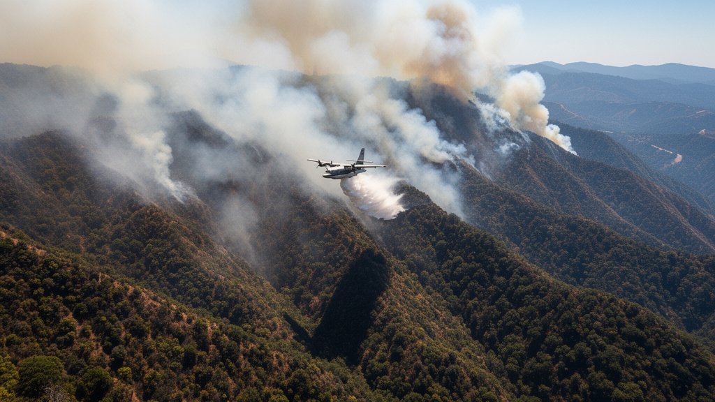
As the Timber fire continues to tear through the rugged terrain of California’s Los Padres National Forest, the situation for one of the world’s most recognizable tourist regions has become critical. The blaze has rapidly expanded to 2,000 acres, forcing emergency officials to issue mandatory evacuation orders for iconic tourist destinations throughout the Big Sur area. With flames encroaching on critical infrastructure, the region is bracing for what officials describe as a high-stakes battle to contain the inferno before it impacts further historical and commercial assets.
Key Highlights
- Fire Scope: The Timber fire has scorched 2,000 acres of dense, difficult-to-navigate terrain within the Los Padres National Forest.
- Personnel Response: Nearly 500 emergency personnel, including specialized wildfire crews and air support, are currently on the ground and in the air fighting the containment efforts.
- Evacuation Status: Authorities have issued urgent evacuation orders covering multiple high-traffic tourist destinations and residential zones in the Big Sur vicinity.
- Containment Challenge: Steep slopes and heavy vegetation within the forest are complicating the suppression efforts, with officials warning of erratic fire behavior.
The Battle to Contain the Timber Fire
The Timber fire represents a significant escalation in California’s wildfire season, challenging the logistical capabilities of emergency management teams. The Los Padres National Forest, known for its steep, mountainous geography and limited access points, has become a hotbed of activity as ground crews and aerial units converge to suppress the flames. The 2,000-acre burn perimeter is not static; high wind gusts and the accumulation of dry brush have allowed the fire to jump lines, forcing command centers to constantly re-evaluate their containment strategies.
Tactical Challenges in Rugged Terrain
The primary obstacle facing the 500 emergency personnel is the physical topography of the Big Sur coast. Unlike urban wildfires, where firebreaks can be cut through paved or flat surfaces, the Los Padres National Forest features precipitous canyons and narrow ridges. These conditions make ground-based firefighting dangerous and slow. Firefighting teams are relying heavily on fixed-wing aircraft and helicopters to perform water drops, attempting to cool the fire’s edge and protect the evacuation routes that thousands of tourists rely on to leave the area. The sheer density of the chaparral in this region acts as fuel, contributing to the intensity of the blaze.
Protecting Iconic Landmarks
Big Sur is more than just a destination; it is an economic and cultural pillar for the Central Coast. The evacuation orders have effectively shuttered some of the region’s most famous lodges, restaurants, and viewing points. The concern for authorities extends beyond current safety to the potential long-term damage to the landmarks that define the Highway 1 corridor. The evacuation process itself has been described as ‘organized but urgent,’ with local law enforcement coordinating with traffic management teams to ensure that visitors—many of whom are unfamiliar with the area’s limited escape routes—can clear the zone before road closures are fully enforced.
The Economic Ripple Effect
Beyond the immediate threat to life and property, the Timber fire creates an immediate economic vacuum. The Big Sur tourism industry operates on thin margins and high turnover; closures during peak season or even mid-season ripple through the regional economy. Local businesses, from boutique hotels to coastal service stations, are now facing the uncertainty of the blaze’s duration. Historical data from previous regional fires suggests that even after containment, the recovery phase for tourism can last weeks or months due to road repairs, utility restoration, and the time required for visitor confidence to return.
Climate and Future Resilience
This incident highlights the growing urgency of managing wildfire risk in climate-sensitive corridors. As the frequency of these events increases, the intersection of tourism, environmental conservation, and disaster preparedness is under scrutiny. The Los Padres National Forest is a diverse ecosystem, and the long-term environmental impact of a fire of this scale involves soil degradation and potential landslides during subsequent rainy seasons. Experts emphasize that the management of this fire is a bellwether for how the state will handle future wildfire threats in similarly remote, high-traffic wilderness areas.
FAQ: People Also Ask
Q: Are the major highways in Big Sur closed due to the Timber fire?
A: While officials are continuously updating road status, the evacuation orders have resulted in localized closures. Travelers are strongly advised to check the latest California Department of Transportation (Caltrans) updates before planning any travel near the Los Padres National Forest or Highway 1.
Q: How many people are involved in fighting the fire?
A: Currently, nearly 500 emergency personnel are engaged in containment efforts, including specialized ground crews, fire suppression engines, and aerial support units.
Q: What should tourists currently in the Big Sur area do?
A: If you are in an area under an evacuation order, you must leave immediately. Follow all instructions provided by local law enforcement and emergency services. Do not attempt to stay to document the event, as this hampers emergency response vehicles and puts your life at risk. Monitor local radio and official emergency social media channels for real-time evacuation zone updates.