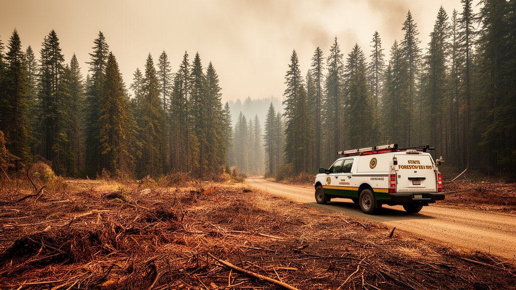
As Washington state grapples with its third-largest wildfire season this century, the arrival of August brings heightened anxiety to Western Washington. With over 720,000 acres already scorched across the state, fire officials are bracing for a volatile month where persistent heat and tinder-dry conditions threaten to turn local vegetation into high-risk fuel zones.
Key Highlights
- Historical Scale: The 2026 wildfire season has surpassed major benchmarks, officially ranking as the third-largest season of the 21st century with 720,000 acres burned to date.
- Western Shift: While Eastern Washington has historically borne the brunt of fire activity, Western Washington is experiencing an unusual uptick in risk due to anomalous August high-pressure systems.
- Emergency Alert: State authorities are urging residents in the Wildland-Urban Interface (WUI) to update evacuation plans immediately as fuel moisture levels reach critical lows.
- Resource Strain: State and federal firefighting resources are currently operating at maximum capacity, with further deployments requested to manage containment lines.
The Unprecedented Summer of 2026
The 2026 fire season in Washington state has defied traditional seasonal curves, accelerating early and showing little sign of the dampening effect typically seen in late July. Data from the Department of Natural Resources (DNR) confirms that the state has hit a grim milestone, with 720,000 acres now officially confirmed as burned. This puts the current year in the company of the state’s most destructive periods in the last hundred years, trailing only the historic mega-seasons of the early 2000s.
For meteorologists and fire ecologists, the anxiety surrounding August is rooted in the cumulative effect of long-term drought conditions. The “fuel moisture content”—a critical metric for firefighters determining how easily vegetation ignites—is currently at levels not seen in a decade. This means that even minor ignition events, such as a localized lightning strike or an accidental human spark, have a much higher statistical probability of escalating into a large-scale conflagration.
The Shifting Geography of Fire Risk
Historically, the Cascade Mountains have acted as a climatic divide, with the rain-shadowed east side bearing the brunt of large-scale wildfires. However, this year has demonstrated a troubling shift. Atmospheric stability patterns have trapped stagnant, hot air over Western Washington, drying out the dense evergreen forests that are typically resilient to fire.
This phenomenon is being observed in the corridors between the Cascade foothills and the I-5 urban corridor. The danger here is exacerbated by the Wildland-Urban Interface (WUI), where residential developments intermingle with undeveloped forest land. When fire moves into these areas, the focus shifts rapidly from containment to life-safety preservation, forcing evacuations and straining local infrastructure that is not historically hardened against wildfire activity.
Climate Dynamics and Fuel Loads
Experts are pointing to a combination of “heat dome” events and long-range precipitation deficits as the primary drivers of this year’s activity. Unlike previous years where early moisture provided a buffer, the 2026 spring runoff concluded prematurely, leaving the sub-surface soil layers critically dry.
This has created a two-tiered problem for suppression efforts. First, the surface fuels—grasses and dead underbrush—are ready to burn at a moment’s notice. Second, the deep-rooted fuel loads, including stressed timber stands, have begun to exhibit moisture levels usually reserved for the high-risk months of September. Consequently, fire managers are seeing “extreme fire behavior” even in the early hours of the day, a trend that usually only manifests during peak afternoon heating.
Secondary Angles: Economy, Infrastructure, and Future Outlook
The Economic Shadow of Suppression
Beyond the immediate physical destruction, the economic toll of the 2026 season is mounting. The state’s emergency suppression budget, originally forecasted for a standard fire year, has been depleted by more than 60% as of August 1. This forces a reallocation of funds from other essential services, including infrastructure maintenance and school support, to cover the logistical costs of aerial firefighting, crew staging, and equipment mobilization.
Insurance and the Housing Market
The insurance sector is closely monitoring the 2026 data. In many parts of Western Washington, homeowners who previously considered themselves “low risk” are seeing premiums adjust upward. There is a growing concern among regional planners that, if this trend of severe fire years continues, the long-term insurability of properties in the WUI could face a significant crisis, potentially impacting real estate valuations and new development projects in these regions.
A New Definition of ‘Fire Season’
Climate modelers are suggesting that we may need to redefine what constitutes a “fire season” in the Pacific Northwest. The data from 2026 suggests that the traditional late-summer fire window is expanding into a nearly year-round threat. This “year-round fire reality” requires a fundamental change in how state and local governments approach zoning, building codes, and community education. The goal is no longer just to prevent fires, but to build resilient communities that can coexist with the inevitable fire events that are becoming a hallmark of the new climate reality.
FAQ: People Also Ask
Q: What is the Wildland-Urban Interface (WUI) and why is it dangerous?
A: The WUI is the zone where human housing meets undeveloped forest or brush. It is dangerous because it forces first responders to balance protecting private property with the physical challenges of fighting fire in dense, sometimes inaccessible terrain. When fires reach these areas, the risk to human life and critical infrastructure increases exponentially.
Q: How does the current acreage burned compare to previous years?
A: With over 720,000 acres burned, 2026 is officially the third-largest wildfire season in Washington state this century. This puts it behind only the most severe mega-seasons recorded in the last 25 years, marking a statistically significant departure from average annual figures.
Q: Why is Western Washington experiencing such high risk this year?
A: Western Washington is experiencing elevated risk due to stagnant, high-pressure heat systems that have pushed moisture levels in vegetation to historic lows. This disrupts the area’s typical cool, maritime climate, allowing fire to spread through vegetation that is usually damp enough to resist ignition.
Q: What should residents do to prepare for potential fire threats?
A: Authorities recommend creating a “defensible space” around homes by clearing dead vegetation and debris, having an emergency “go bag” ready with essential documents, and signing up for local government emergency alert notifications. Familiarity with local evacuation routes is critical.