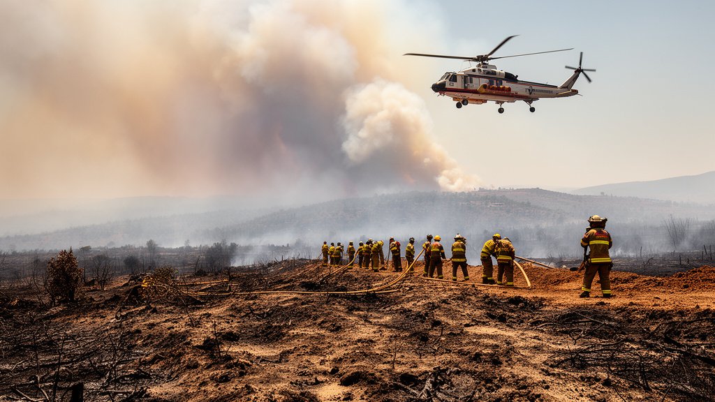
California’s emergency response apparatus is being pushed to its absolute limits this week as state and federal agencies struggle to contain multiple active wildfires. The confluence of hot, dry weather patterns and simultaneous, high-intensity fire events has created a volatile operational environment. With the Timber Fire carving through the rugged, inaccessible terrain of Big Sur and the colossal Bug Fire threatening regions near the Nevada border, the state’s firefighting workforce is navigating an increasingly narrow margin of safety and suppression capacity. The pressure on the ground is palpable, as commanders weigh the need for rapid containment against the critical requirement to protect exhausted crews operating in dangerous conditions.
Key Highlights
- The Timber Fire (Big Sur): Currently burning through 4,655 acres of challenging coastal terrain with containment efforts reaching 12%.
- The Bug Fire (Reno Vicinity): A significant escalation in regional threat, consuming 93,381 acres, requiring massive inter-agency deployment.
- Resource Strain: The simultaneous nature of these blazes is thinning the availability of Incident Management Teams (IMTs) and specialized aerial assets.
- Environmental Factors: Unseasonably hot and dry conditions are lowering fuel moisture levels, creating prime environments for rapid fire progression.
The Tactical Reality: Confronting Simultaneous Mega-Fires
The current wildfire situation in California represents a masterclass in the complexities of modern fire management. When multiple major incidents occur simultaneously, the strategy shifts from total suppression to triage—prioritizing the protection of human life and critical infrastructure over the containment of isolated acreage. This approach is rarely simple, particularly when geography dictates the pace of the battle.
The Challenge of the Timber Fire
In Big Sur, the Timber Fire presents a formidable tactical challenge. The topography of the Big Sur coast is notoriously difficult, characterized by steep, unstable cliffs and dense vegetation that limits ground access. Firefighters are frequently forced to rely on aerial resources, including fixed-wing tankers and heavy helicopters, to create containment lines. However, the 12% containment figure indicates just how difficult this terrain is to secure. The fire is burning in areas that are not only difficult for crews to reach on foot but also challenging for heavy machinery. Every gallon of water and line of fire-retardant dropped in Big Sur is a calculated logistical operation, hampered by the very coastal microclimates that typically provide moisture to the region.
The Scale of the Bug Fire
Contrasting sharply with the terrain-heavy battle in Big Sur is the Bug Fire, which has scorched a staggering 93,381 acres near the Reno border. Unlike the vertical, confined fighting in Big Sur, the Bug Fire is a landscape-scale event. With nearly 100,000 acres consumed, the fire moves with a momentum that can outpace ground crews. The strategy here focuses on containment perimeters and evacuation management, utilizing thousands of personnel to protect the wildland-urban interface. The scale of the Bug Fire serves as a sobering reminder of how quickly fire can dominate the high-desert and scrubland ecosystems common to the Nevada-California border, turning days of work into shifting variables within hours.
The Human Toll: Workforce Fatigue
Perhaps the most overlooked element of this crisis is the cumulative fatigue of the California Department of Forestry and Fire Protection (CAL FIRE) and U.S. Forest Service personnel. Firefighting is inherently exhausting, but the current operational tempo is testing the resilience of these teams. Understaffing or the over-extension of specialized crews—such as hotshot crews and smokejumpers—increases the risk of injury and tactical errors. When fires burn concurrently, the rotation cycles that typically allow for recuperation are shortened or canceled. This exhaustion is not just a morale issue; it is a safety concern that limits the efficiency of the response. Commanders are now forced to factor the ‘human resource shelf-life’ into their daily strategic briefings, ensuring that teams on the ground are mentally and physically prepared to handle the unpredictable behavior of the fires they are facing.
The Changing Landscape of Wildfire Management
Beyond the immediate tactical response, these fires highlight the evolving challenge of fire management in the 21st century. The ‘new normal’ involves longer fire seasons and a narrowing window of opportunity to perform prescribed burns or fuel mitigation.
The Role of Technology and Intelligence
Agencies are increasingly reliant on Geographic Information Systems (GIS) and real-time satellite imagery to map these fires. The integration of infrared sensors and AI-driven predictive modeling allows Incident Commanders to anticipate fire movement before it happens. In the case of the Bug Fire, real-time data feeds have been essential for deploying evacuation resources in advance of the fire front. However, technology is an additive to, not a replacement for, the boots-on-the-ground reality. No satellite imagery can replace a fire line dug by hand in the steep canyons of Big Sur, nor can an algorithm replace the split-second decision-making of a crew captain seeing the wind shift in real-time.
Economic and Ecological Impacts
The long-term consequences of these fires extend far beyond the immediate containment percentages. In Big Sur, the fire threatens not only ecological biodiversity but also the tourism-dependent local economy. When highways are closed and access is restricted, the economic ripple effects are felt throughout the region. Meanwhile, the sheer acreage of the Bug Fire suggests a profound impact on local watersheds and air quality. As the state moves forward, the strategy will inevitably turn toward massive reforestation and soil stabilization efforts to prevent the secondary disasters that often follow, such as mudslides and debris flows during the rainy season.
FAQ: People Also Ask
Q: What does ‘12% contained’ actually mean in the context of the Timber Fire?
A: Containment does not mean the fire is out. It means that 12% of the fire’s perimeter has been secured by a barrier—either natural (rivers, rock outcroppings) or man-made (firebreaks, bulldozed lines)—that the fire is unlikely to jump. The remaining 88% is still active, requiring constant monitoring.
Q: Why does a fire near Reno impact California’s resource distribution?
A: Wildfire response is a highly cooperative effort. Firefighting resources, especially specialized equipment and elite Hotshot crews, are shared across state lines through mutual aid agreements. A massive blaze like the Bug Fire draws resources away from other jurisdictions, creating a ripple effect of strain across the entire Western United States.
Q: How do firefighters manage the fatigue caused by these intense heat conditions?
A: Fire management teams utilize a strict ‘work-rest’ ratio, often implementing 24-hour shift rotations. They monitor crew hydration levels and utilize ‘spike camps’ that provide basic recovery facilities. Despite these protocols, the psychological and physical intensity of battling mega-fires creates a cumulative strain that is difficult to fully mitigate.
Q: Are these fires being driven primarily by climate change?
A: While individual fires are complex events caused by specific ignition sources and local weather, climate scientists point to the trend of ‘fire weather’—longer, hotter, drier seasons—as a significant multiplier that makes fires more aggressive and harder to contain than they were in previous decades.