A series of warm-water pulses known as Kelvin waves are tracking northward along the West Coast, threatening to drive sea levels up by as much as one foot between October 2026 and February 2027, compounding the existing risks associated with a super El Niño event.
Key Highlights:
- Up to one foot of temporary sea level rise is projected for the Pacific coastline between October 2026 and February 2027.
- Kelvin waves, which are massive pulses of warm water, are the primary driver of this seasonal anomaly.
- The current super El Niño event significantly amplifies these surges, creating a compounded threat for coastal regions.
- Increased flooding, accelerated erosion, and stress on coastal infrastructure are the primary risks for municipalities from California to Washington.
- Scientists are closely monitoring data from organizations including NOAA and the Pacific Marine Environmental Laboratory to track the waves’ trajectory.
The Oceanographic Anomaly Reshaping Our Coastline
The Pacific Ocean is currently stage-setting a complex geophysical event that requires immediate attention from coastal managers, emergency planners, and residents alike. Beginning in October 2026 and extending through February 2027, the West Coast of the United States will experience a series of Kelvin waves—vast, subsurface pulses of warm water that travel eastward across the equatorial Pacific before refracting northward along the American coastline.
Unlike tides or storm surges, which are driven by wind or gravitational pull, Kelvin waves are deep-ocean phenomena. When they hit the West Coast, they release pent-up heat and water mass, causing a measurable “bulge” in sea level that can persist for weeks or months. During this specific window, the interaction between these waves and the ongoing super El Niño—a climate pattern characterized by anomalously warm surface waters—creates a “double threat” scenario. The El Niño condition already lowers the cold-water thermocline, and the arrival of Kelvin waves effectively piles warm water against the shoreline, leading to sea level anomalies of up to one foot above predicted tide levels.
The Mechanics of the Surge: Why Timing Matters
To understand the severity of this event, one must look at the Pacific Marine Environmental Laboratory (PMEL) data. Kelvin waves are essentially gravity waves that are trapped along the equator by the Earth’s rotation. When they reach the South American coastline, they are forced to turn and travel poleward as coastal-trapped waves. As they migrate north toward California, Oregon, and Washington, they alter the geostrophic balance of the nearshore environment.
This specific event, slated for late 2026 into early 2027, is notable because the intensity of the super El Niño provides an energetic backdrop. In typical years, a Kelvin wave might cause a minor, often unnoticeable sea level rise. However, with the background state of the ocean already elevated by warm water expansion, the peak of the Kelvin wave will be compounded. Coastal regions should prepare for the possibility that high tides, combined with these anomalies, will breach natural protective barriers, specifically in low-lying coastal plains and older, low-elevation infrastructure developments.
Economic and Infrastructure Vulnerability
Beyond the raw oceanography, the economic implications are significant. The California Coastal Commission and local municipal governments have historically struggled with the long-term planning of “managed retreat” versus “armoring” the coastline. A transient, foot-high sea level rise does not merely threaten beachfront properties; it forces an immediate stress test on existing drainage systems, storm sewers, and emergency evacuation routes.
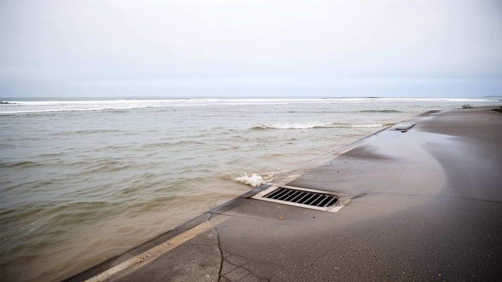
When sea levels rise by even a few inches above normal, saltwater intrusion into storm drains can effectively negate their ability to shed heavy winter rainfall—a common occurrence during the typical stormy season in the Pacific Northwest. This creates a scenario where flooding occurs from both directions: the sea pushing in and the rainfall unable to drain out. Investors and homeowners in flood-prone zones should be monitoring local emergency management announcements, as insurance premiums and local flood risk classifications are historically reactive to the data collected during these specific high-water events.
Historical Context and Future Adaptations
The scientific community uses these events to refine models of long-term climate change. While Kelvin waves are a natural variability, the super El Niño intensity is becoming a subject of intense study regarding climate change attribution. For the National Weather Service and the National Oceanic and Atmospheric Administration (NOAA), this period serves as a critical data collection window. They will be using satellite altimetry—measuring the exact height of the ocean surface from space—to track the propagation of these waves with centimeter-level precision.
For the public, this highlights the necessity of localized climate adaptation. As the frequency and intensity of ENSO (El Niño Southern Oscillation) events fluctuate, the “new normal” for the West Coast is one of high volatility. Relying solely on historical flood maps is increasingly dangerous, as they often fail to account for these specific, transient pulses of water that can dramatically alter the impact of a standard winter storm.
FAQ: People Also Ask
What is a Kelvin wave exactly?
Kelvin waves are massive, deep-water pulses of warm water that move across the Pacific Ocean. They are essentially gravitational waves that are constrained by the equator. When they reach the coast, they reflect and move north or south, causing localized sea level rises.
Why does this only happen during El Niño?
While Kelvin waves occur occasionally, El Niño conditions—which feature a deeper warm-water pool in the Pacific—provide the energy and the specific atmospheric-oceanic coupling required to generate larger, more frequent, and more impactful waves that significantly raise coastal water levels.
Will this damage homes directly?
For most, this will appear as higher-than-average high tides. However, for homes located in low-lying, flood-prone, or erosion-sensitive zones, the added foot of water can be the difference between a dry crawlspace and a flooded first floor, especially if the Kelvin wave peak coincides with a major winter storm event.
Is this permanent climate change?
No. This is a transient, multi-month phenomenon driven by oceanic variability. Once the Kelvin wave passes and the El Niño event dissipates, sea levels will return to their baseline. However, it provides a glimpse into the challenges the coastline will face as long-term sea levels continue to rise.