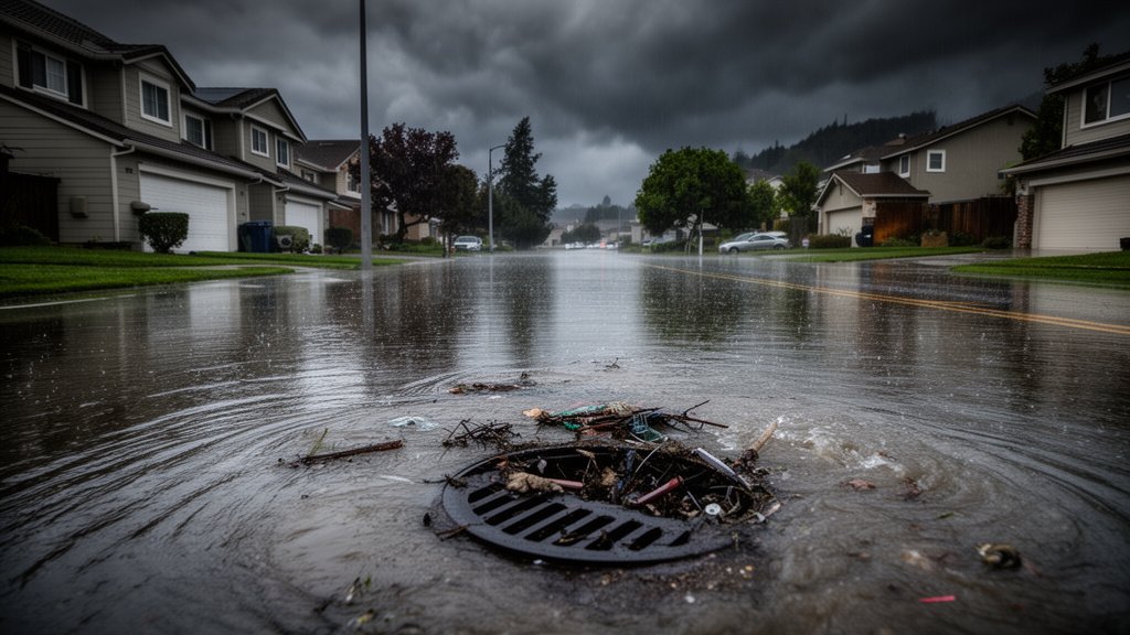
A historic atmospheric river has hammered Northern California, unleashing a torrent of precipitation that shattered long-standing rainfall records in San Francisco and overwhelmed municipal drainage systems across the Bay Area. The massive weather system, characterized by a concentrated plume of water vapor extending across the Pacific, delivered a relentless barrage of moisture, resulting in localized catastrophic flooding, particularly in Santa Clara County. As the storm system tracks southward, emergency management agencies have issued urgent warnings for Southern California, citing high probabilities of flash flooding, mudslides, and hazardous travel conditions.
Key Highlights
- Record-Breaking Precipitation: San Francisco recorded one of its wettest 24-hour periods in history, significantly surpassing historical averages for the current calendar period.
- Santa Clara Flooding: Urban infrastructure in Santa Clara struggled to cope with the sheer volume of water, resulting in flooded arterial roads and residential property damage.
- Southern California Alerts: The National Weather Service (NWS) has escalated warnings for Southern California, focusing on debris flows and potential mudslides in burn-scarred regions.
- Atmospheric River Intensity: Meteorologists have categorized this event as a high-magnitude atmospheric river, fueled by unusually warm Pacific moisture.
The Meteorological Surge: Understanding the ‘Atmospheric River’
The term ‘atmospheric river’ has become synonymous with California’s winter weather extremes, yet the recent event represents a particularly potent iteration of this phenomenon. At its core, an atmospheric river acts as a conveyor belt of water vapor, carrying massive amounts of moisture from the tropics to mid-latitude regions. When this plume makes landfall, it is forced upward by mountain ranges, causing the air to cool, condense, and fall as extreme precipitation.
The Science of the Deluge
According to data from the National Weather Service, this specific system was characterized by high integrated vapor transport (IVT), a metric used to measure the intensity of the water vapor flux. In San Francisco, the sustained rainfall not only broke daily accumulation records but also challenged the capacity of historical storm drain networks. The rapid onset of the storm meant that soil saturation reached critical levels in a matter of hours, leading to immediate surface runoff and ponding.
The San Francisco Record
While rainfall totals fluctuate based on specific gauging stations, the downtown San Francisco area reported figures that effectively eclipsed records established decades ago. Meteorologists noted that the convergence of the atmospheric river with a localized low-pressure system created a ‘firehose’ effect, anchoring the heaviest precipitation directly over the San Francisco Peninsula for several critical hours. This forced a re-evaluation of current hydrological models, which had initially underestimated the duration of the peak intensity.
Infrastructure Under Pressure: The Santa Clara Response
As the storm moved inland, Santa Clara County bore the brunt of the runoff. The geography of the region, combined with significant urban density, created a recipe for rapid flood accumulation. Municipal crews were deployed throughout the night, clearing storm drains clogged by debris—an ongoing issue as the region faces its most significant weather stress test in recent years.
Challenges in Urban Flood Management
In Santa Clara, the flooding was not merely a result of total volume but of rate-of-fall. The intensity of the precipitation exceeded the infiltration capacity of the ground, forcing water onto surface streets. Local authorities have emphasized that this event highlights the vulnerability of aging drainage infrastructure in Northern California. ‘We are seeing the consequences of systems designed for the climate of thirty years ago struggling to manage the extreme variability of today’s weather,’ noted one local water management official during a morning briefing.
Emergency Protocols and Resident Safety
Local emergency services responded to numerous vehicle rescues as drivers attempted to navigate flooded intersections. The primary safety message remains consistent: ‘Turn around, don’t drown.’ Residents in low-lying areas are being encouraged to sign up for reverse-911 alerts and to prepare emergency kits, as the saturate soil conditions mean that subsequent, lighter rain events could still trigger significant issues.
The Looming Threat: Southern California’s Outlook
While the worst of the moisture in the Bay Area has begun to taper, the storm’s trajectory presents a distinct threat to Southern California. The National Weather Service has issued a Flood Watch for a wide swath of the region, including Los Angeles and San Diego counties.
The Danger of Burn Scars
Perhaps the most pressing concern for Southern California officials is the potential for debris flows. Areas previously scorched by wildfires lack the vegetation required to anchor soil. With the ground already nearing saturation, the additional heavy rainfall expected from the tail end of this atmospheric river increases the likelihood of landslides. Residents near recent burn zones have been placed on high alert for evacuation orders should precipitation rates exceed safety thresholds.
Preparing for the Long Tail
Meteorologists are monitoring the ‘long tail’ of the system—the secondary, less intense bands of rain that follow the primary front. While less dramatic than the initial arrival, these bands often provide the final trigger for mudslides. Consequently, the alert status remains elevated across all major metropolitan areas in the southern half of the state.
Assessing Long-Term Impacts
As California moves into the aftermath of this event, the discussion shifts to resilience and adaptation. The agricultural sector, which relies on these wet cycles to replenish reservoirs, faces a mixed reality: while the water is necessary for drought mitigation, the intensity causes significant damage to orchard crops and topsoil integrity.
Historical Context of California Weather
Comparing this event to the atmospheric rivers of 2023 provides valuable context. While the previous year saw a series of back-to-back systems that saturated the entire state, this event was characterized by a more concentrated, high-impact focus. Historians and climatologists are observing a trend toward these ‘megastorms,’ where the variability of California’s wet season becomes more erratic, shifting from prolonged droughts to extreme, singular deluge events.
The Future of Infrastructure
Moving forward, the conversation among policymakers is centered on the modernization of water capture systems. If California is to manage this ‘boom and bust’ cycle, the infrastructure must pivot from merely ‘drainage’ to ‘retention and recharge,’ utilizing the landscape to store the excessive water before it flows into the Pacific. This event serves as a stark reminder of the state’s ongoing struggle to balance environmental volatility with urban expansion.
FAQ: People Also Ask
Q: What is an atmospheric river?
A: An atmospheric river is a long, narrow region in the atmosphere—essentially a ‘river in the sky’—that transports vast amounts of water vapor from the tropics to higher latitudes. When it makes landfall, it often results in heavy precipitation.
Q: Why was the flooding in Santa Clara so severe?
A: The flooding was primarily driven by the ‘rate-of-fall’ of the rain, which exceeded the capacity of local urban storm drainage systems. When precipitation falls faster than the soil can absorb or the drains can move it, surface flooding is the inevitable result.
Q: Is this event related to climate change?
A: While individual weather events are complex, scientists consistently point to atmospheric rivers becoming more intense in a warmer climate. A warmer atmosphere holds more water vapor, which essentially ‘supercharges’ these storms, leading to more extreme rainfall totals when they make landfall.
Q: What should Southern California residents do to prepare?
A: Residents in Southern California, particularly those in or near recent burn scars, should monitor local NWS updates, prepare emergency bags, know their evacuation routes, and avoid unnecessary travel during heavy downpours.