Los Angeles County residents are facing critical safety alerts as a relentless atmospheric river system brings torrential rainfall, triggering widespread evacuation warnings and raising severe flood concerns across the region. Emergency management agencies are currently responding to localized flooding, mudslides, and road closures, signaling a heightened state of alert for communities positioned near vulnerable burn scars and low-lying coastal areas.
Key Highlights
- Mandatory Evacuations: Authorities have issued immediate orders for residents in high-risk zones, particularly those near recent wildfire burn scars where soil stability is severely compromised.
- Flood Risk Assessments: The National Weather Service (NWS) has extended Flash Flood Watches as saturation levels reach critical thresholds, increasing the probability of debris flows.
- Infrastructure Impact: Significant road closures are impacting travel through canyon roads and low-lying arterial routes in Los Angeles County, complicating emergency response and daily commutes.
- Emergency Deployment: First responders are working in high-visibility conditions to manage rescues and maintain perimeter security around at-risk neighborhoods.
The Atmospheric Crisis: Understanding the SoCal Deluge
The current meteorological event affecting Southern California is a classic, high-moisture atmospheric river—a long, narrow region in the atmosphere that transports most of the water vapor outside of the tropics. Unlike the standard Pacific storms that typically roll through the region, this specific system has stalled, concentrating rainfall over Los Angeles County with devastating precision. For residents, this means that even short periods of relative calm are interrupted by intense, convective bursts of rain that overwhelm storm drains and soil absorption capacities alike.
The Science of Burn Scars and Debris Flows
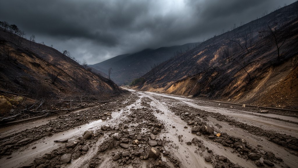
Perhaps the most dangerous element of this weather event is not the rain itself, but the interaction between the precipitation and the local topography. In areas recently ravaged by wildfires, the soil has undergone a chemical change known as hydrophobicity—a condition where the heat from the fires creates a waxy, water-repellent layer on the ground. When heavy rain hits these surfaces, it does not soak in. Instead, it sheet-flows over the land, carrying with it ash, boulders, and scorched vegetation, coalescing into massive, destructive debris flows. These flows can gain enough momentum to destroy homes and sweep vehicles off roads within seconds, which is why the Los Angeles County Office of Emergency Management has been aggressive in their issuance of evacuation warnings.
Economic and Commuter Disruptions
Beyond the immediate physical danger to life and property, the storm is inflicting substantial economic strain. Los Angeles, a region built on a complex web of interconnected arterial highways and canyon passes, is particularly sensitive to road closures. When a major thoroughfare is compromised by flooding or debris, it creates a ripple effect, choking off supply chains and preventing residents from reaching essential services. Local businesses in flooded zones are reporting significant operational downtime, while municipal budgets are being rapidly deployed to cover the costs of emergency clean-up, barricade installation, and search-and-rescue operations.
Future-Proofing: A New Normal?
As climate patterns shift, Southern California faces a paradoxical future: increasing aridity during the summer months followed by more intense, concentrated precipitation events in the winter. Urban planners are now being forced to re-evaluate the region’s storm-water management infrastructure. The current system, much of it built decades ago, was designed for a different hydrologic reality. Experts argue that moving forward, the integration of ‘sponge city’ concepts—such as permeable pavement, expanded flood basins, and native vegetation restoration—will be essential to mitigating the impact of these severe storms. The current crisis serves as a harsh stress test for this legacy infrastructure, highlighting the urgent need for structural resilience in the face of an increasingly volatile climate.
FAQ: People Also Ask
Q: What is the difference between an evacuation warning and a mandatory evacuation order?
A: An evacuation warning means there is a potential threat to life and property, and you should prepare to leave. A mandatory evacuation order means that the threat is imminent, and residents are legally and practically advised to leave the area immediately for their own safety and to allow first responders access.
Q: Why do burn scars increase the risk of flooding?
A: Burned soil often becomes hydrophobic, meaning it repels water rather than absorbing it. This leads to rapid runoff that can pick up mud, ash, and rocks, resulting in fast-moving debris flows that are far more dangerous than simple water flooding.
Q: Where can I find real-time road closure information during this storm?
A: Residents should monitor the official social media channels for the Los Angeles County Department of Public Works and the California Department of Transportation (Caltrans). Additionally, local news outlets frequently update live traffic maps specifically tailored to flood-related road impacts.
Q: How can I prepare my home for future heavy rain events?
A: Homeowners in high-risk areas should clear rain gutters, install sandbags around low-lying entryways, ensure they have an emergency “go-bag” ready, and monitor local weather alerts via the National Weather Service mobile app.