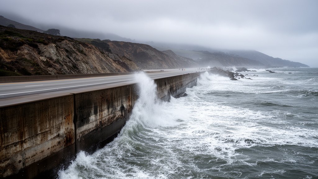
California is currently on high alert as oceanographers and climate scientists track a significant oceanic Kelvin wave traversing the equatorial Pacific. This subsurface pulse of warm water—often invisible to the naked eye but measurable via satellite altimetry—is migrating toward the West Coast. As it arrives, experts warn it is poised to create a ‘supercharged’ environment for coastal flooding, likely exacerbating the impact of winter storms and accelerating the immediate effects of sea-level rise. For coastal communities, this represents a critical nexus between long-term climate trends and short-term, volatile weather events.
Key Highlights
- Subsurface Pulse: Kelvin waves are massive, underwater pulses of warm water that traverse the Pacific Ocean along the equator, effectively raising sea levels when they reach the coast.
- Amplified Storm Surge: When a Kelvin wave reaches the coastline, it suppresses the thermocline and raises sea surface height, which can amplify the impact of high tides and atmospheric river-driven storm surges.
- Infrastructure Vulnerability: Low-lying coastal regions, already stressed by ongoing erosion, face heightened risks of severe inundation and infrastructure damage as the wave interacts with winter high tides.
- Scientific Monitoring: State emergency management agencies are utilizing real-time data from NOAA and global climate models to predict the precise arrival and magnitude of these anomalies.
The Hidden Mechanics of the Kelvin Wave Threat
To understand the gravity of the current situation, one must look beneath the surface of the Pacific. A Kelvin wave is not a wave in the traditional sense, like those seen crashing on a beach. Rather, it is a planetary-scale wave that travels along the equator, moving from the western Pacific toward the Americas. These waves are intrinsic components of the El Niño-Southern Oscillation (ENSO) cycle. When these waves reach the South American coast, they travel poleward, bringing warm, nutrient-poor, and high-volume water that displaces the cooler, denser water usually found along the California coastline.
The ‘Supercharging’ Effect on Sea Levels
The immediate concern for California officials is the mechanism known as ‘sea surface height anomaly.’ When the Kelvin wave hits the continental shelf, it effectively pushes the water level up—sometimes by several inches above predicted tidal levels. While a few inches may seem trivial in the context of global sea-level rise, in a coastal flooding scenario, this marginal increase is often the difference between a minor nuisance and a catastrophic breach of sea walls or levee systems. When this wave converges with astronomical high tides (such as King Tides) or the low-pressure centers of atmospheric rivers—which pull water upward—the result is an compounding effect that can inundate low-lying roads, parking lots, and residential basements that were previously considered safe.
Infrastructure Resilience and the Economic Toll
The economic implications of this phenomenon are substantial. California’s coastal infrastructure, from the Port of Los Angeles to the residential cliffs of Pacifica, is designed for historical tidal norms. As the Kelvin wave passes through, it tests the resilience of aging seawalls, drainage systems, and coastal highways. Local municipalities are currently faced with the challenge of rapid response mitigation: sandbagging vulnerable zones, clearing drainage canals of debris, and coordinating with the National Weather Service to provide hyper-local flood warnings. The long-term economic toll includes the compounding costs of repetitive flooding, which are increasingly difficult for property insurance markets to absorb, leading to premium spikes and, in some cases, the withdrawal of coverage from high-risk zones.
The Intersection of Climate Cycles and Urban Sprawl
Secondary to the immediate flood risk is the broader context of urban planning in the face of a changing ocean. The Kelvin wave serves as a stark reminder that the ocean is not a static boundary but a dynamic, pulsing system. Climate change is already shifting the baseline for sea levels, but Kelvin waves represent the ‘noise’ within that system—volatile, unpredictable pulses that can catch even prepared cities off guard. This event is pushing the conversation regarding ‘managed retreat’ versus ‘hardened infrastructure’ back to the forefront of state legislative sessions. Can California build its way out of this with taller seawalls, or is the ocean forcing a conversation about land-use reform? As the Kelvin wave interacts with rising global sea levels, the margin for error for coastal engineering is narrowing rapidly.
FAQ: People Also Ask
What exactly is an oceanic Kelvin wave?
An oceanic Kelvin wave is a large-scale disturbance that travels along the equator from the western Pacific to the eastern Pacific. It is a subsurface wave that deepens the thermocline, shifting warm water across the basin and raising the sea surface height when it strikes the coast.
How long will this impact last?
Unlike a single storm surge that lasts for hours, the effects of a Kelvin wave can persist for weeks or even months depending on the duration of the wave’s passage. During this period, the baseline for sea levels is elevated, making every high tide and storm event more dangerous until the pulse passes.
Is this wave related to global warming?
While Kelvin waves are natural parts of the El Niño-Southern Oscillation (ENSO) cycle, climate change can influence their frequency and intensity. Furthermore, the baseline sea-level rise caused by climate change ensures that when these waves arrive, they have a higher starting point from which to surge, making the flooding more severe than it would have been in previous decades.