Governor Gavin Newsom declared a state of emergency across California on September 21, 2026, as climate models and meteorological data converge to signal a “super El Niño” weather pattern poised to deliver record-breaking winter storms, catastrophic flooding, and severe coastal erosion throughout the state. The proclamation serves as a preemptive strike, directing state agencies to expedite infrastructure hardening, clear storm drains, and bolster emergency response protocols before the brunt of the weather system makes landfall.
Key Highlights
- State of Emergency: Governor Newsom’s September 21, 2026, executive order triggers immediate resource allocation for flood prevention and disaster readiness.
- National Guard Deployment: The California National Guard is authorized to mobilize, providing rapid response capabilities for search-and-rescue operations and levee reinforcement.
- Infrastructure Hardening: State agencies are ordered to prioritize critical infrastructure, including transport networks, utility grids, and coastal defenses against impending erosion.
- Climate Forecast: Experts cite high equatorial Pacific sea-surface temperatures as the primary driver for a “super” event, potentially mirroring the destructive impact of the 1997-98 cycle.
Strengthening the Frontlines: California’s Strategic Mobilization
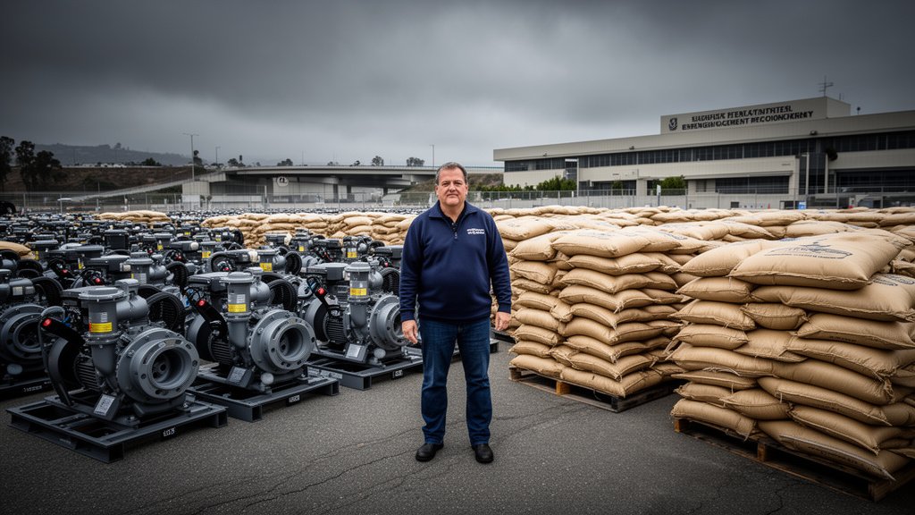
The declaration of a state of emergency is not merely administrative; it is a tactical pivot in California’s disaster management strategy. By invoking emergency powers, the Governor has bypassed typical bureaucratic procurement timelines, allowing local jurisdictions and state departments to secure sandbags, industrial pumps, and flood-mitigation supplies with unprecedented speed. This preemptive approach contrasts with the reactive posture of previous decades, reflecting a shift in how the state manages the increasing frequency of extreme climate events.
The Anatomy of a ‘Super’ El Niño
The classification of this event as a “super El Niño” is based on specific oceanic and atmospheric criteria. Sea surface temperatures in the central and eastern Pacific have surpassed the 2.5-degree Celsius threshold above average, a metric historically associated with extreme, high-impact weather patterns. When this oceanic warming couples with the jet stream, it creates a pipeline for atmospheric rivers—narrow, dense bands of concentrated water vapor that dump massive amounts of precipitation in short durations. For California, this means that the risk is not just total rainfall volume, but the intensity of the precipitation, which can overwhelm local drainage systems in minutes.
Protecting Critical Infrastructure
A primary focus of the emergency proclamation is the protection of the state’s arterial infrastructure. In prior, less severe cycles, the combination of coastal storm surges and intense rainfall led to significant highway washouts and hillside collapses. The current mobilization includes the inspection and reinforcement of key transportation corridors, including portions of Highway 1 and critical rail lines serving the Port of Los Angeles and the Port of Long Beach. Preventing supply chain disruption is a secondary, yet vital, economic objective of the state’s intervention. By securing these logistics hubs now, the state aims to maintain the flow of commerce even while weather conditions degrade throughout the winter months.
Lessons from History: The 1997 and 2016 Benchmarks
Emergency planners are using the historical data from the 1997-1998 and 2015-2016 El Niño events as a blueprint for the current response. The 1997 event resulted in nearly $1 billion in damages across California, with significant impacts on agricultural sectors and residential real estate in coastal counties. While current flood-control technology—such as satellite-aided mapping and real-time sensor networks—is significantly more advanced than in 1997, the sheer volume of anticipated water remains a formidable challenge. The National Guard’s involvement is specifically designed to bridge the gap between local emergency capabilities and the potential scale of regional flooding, ensuring that rural and isolated communities are not cut off from essential services.
Economic and Environmental Resilience
The economic impact of a “super El Niño” extends beyond emergency costs. California’s agricultural sector, a pillar of the state’s economy, faces a dual-edged sword: while the rain is necessary to replenish depleted reservoirs, the velocity of the storm front threatens to destroy crops, erode topsoil, and flood fields. Furthermore, the insurance market in California, already stressed by recent wildfire seasons, is watching the situation closely. The state’s early declaration is also a signal to the insurance and reinsurance markets that California is taking proactive steps to mitigate risk, which could play a crucial role in maintaining regional economic stability throughout the winter season.
FAQ: People Also Ask
1. What does it mean when the Governor declares a ‘State of Emergency’?
It is a legal designation that allows the Governor to suspend certain regulations, redirect state funds, and mobilize state resources, including the California National Guard, to respond to a specific threat. It acts as a “force multiplier” for local government agencies.
2. How long is this emergency declaration expected to last?
While the proclamation is effective immediately as of September 21, 2026, the emergency status remains in effect until the threat posed by the El Niño storm season subsides. It is typically revisited monthly by the Governor’s Office of Emergency Services (Cal OES).
3. What specific risks does a ‘super El Niño’ pose to coastal residents?
The primary risks are severe coastal erosion, storm surges, and the threat of high tides undermining cliffside and beachfront structures. Homeowners in vulnerable areas are being advised to consult local flood zone maps and prepare for potential evacuations.
4. Is this weather event related to climate change?
While El Niño is a natural climate cycle, atmospheric science suggests that climate change is exacerbating the intensity and frequency of these events. The warming of the Pacific Ocean acts as a fuel source, making the resulting storms more potent and wetter than they would be in a non-warmed climate.