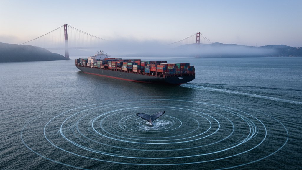
As the San Francisco Bay remains one of the most vital arteries of global commerce, it is also becoming a perilous thoroughfare for gray whales. Can tech keep whales safe from deadly vessel strikes? This is the critical question currently being answered by the Benioff Ocean Science Laboratory (BOSL) at UC Santa Barbara, which is deploying advanced Artificial Intelligence to mitigate a rising mortality rate among these migrating giants.
The Collision Crisis: A Perfect Storm of Geography and Biology
The problem stems from a convergence of factors. San Francisco Bay lies directly along the migratory corridor for gray whales, which travel thousands of miles between their breeding lagoons in Baja California, Mexico, and their feeding grounds in the Arctic. Traditionally, these routes kept the massive mammals offshore. However, shifting ocean temperatures—a direct consequence of climate change—have disrupted the availability of prey, forcing whales to seek food closer to the coast and, subsequently, deeper into busy shipping lanes. When these massive marine mammals surface to breathe, they are often unaware of the rapid approach of massive container vessels, leading to fatal blunt-force trauma.
The AI Solution: How ‘Whale Safe’ Technology Works
The core of the solution is the ‘Whale Safe’ technology initiative. Unlike static, passive monitoring systems of the past, this platform utilizes real-time AI to create a dynamic shield. The system operates on a dual-input architecture:
1. Acoustic Monitoring: A network of hydrophones is deployed at key entrance points to the Bay. These sensors act as the ears of the ocean, listening for the distinct low-frequency vocalizations of gray whales and other species.
2. AI Processing: The collected data is fed into an Artificial Intelligence model capable of filtering through ambient ocean noise—such as crashing waves or seismic activity—to pinpoint the precise call of a whale. Once detected, the system categorizes the frequency and location of the species.
3. AIS Integration: By fusing this data with Automatic Identification System (AIS) information, the system tracks the positions and speeds of commercial vessels in real-time, providing immediate visual alerts to ship captains. It is a digital ‘early warning system’ that allows operators to reduce speeds or alter courses before a collision occurs.
The Climate Change Nexus: Why Migration is Shifting
The ecological necessity for this technology cannot be overstated. Climate-disrupted migration routes mean that whales are not just passing through; they are lingering in areas that overlap with high-traffic zones. NOAA (National Oceanic and Atmospheric Administration) fisheries data suggests that as upwelling events shift, the nutrient-dense water whales rely on moves closer to the shore. This forces the whales to traverse the heavy traffic lanes off the Golden Gate, creating a persistent risk profile that traditional, slow-moving conservation efforts could not manage effectively.
Economic and Logistical Friction: The Slow-Down Dilemma
Implementation of this technology creates a unique economic tension. Commercial shipping schedules are notoriously rigid, with ‘just-in-time’ logistics fueling global consumerism. However, the Whale Safe program encourages voluntary speed reduction to 10 knots or less in high-risk zones. At lower speeds, the lethality of a potential collision drops significantly. The challenge lies in incentivizing shipping lines to adopt these measures. The BOSL team is now using the data gathered by the AI to publicly ‘grade’ shipping companies on their whale-friendliness, leveraging corporate reputation as a tool for ecological compliance.
Future-Proofing Global Ports
The San Francisco Bay deployment serves as a living laboratory for the rest of the world. Similar strategies are currently being examined for implementation in the Port of Rotterdam, the Port of Singapore, and the Port of Los Angeles/Long Beach. By standardizing the ‘Whale Safe’ acoustic model, researchers believe they can create a global, interoperable ‘Ocean Radar’ that protects migratory species across the Northern and Southern Hemispheres, regardless of local shipping volume.
FAQ: People Also Ask
Q: How does the AI differentiate between whale sounds and ship noise?
A: The system uses deep-learning algorithms trained on thousands of hours of annotated marine audio. By isolating the specific acoustic signatures of whale vocalizations from the broadband noise generated by ship propellers and machinery, the AI can trigger alerts even in environments with heavy maritime traffic.
Q: Are these speed limits mandatory for shipping vessels?
A: In the San Francisco area, the 10-knot speed zones are currently largely voluntary, managed by the NOAA and local partners. However, the ‘Whale Safe’ initiative is increasingly successful by publishing rankings, which encourages companies to comply to maintain a green reputation with their stakeholders.
Q: What is the success rate of this technology in preventing strikes?
A: While it is difficult to measure a ‘non-event,’ the primary indicator of success is the reduction of whale presence in high-traffic shipping lanes when ships are moving at high speeds. By providing captains with real-time, high-confidence alerts, the technology has demonstrably cleared shipping lanes of vessel activity during periods of high whale density.