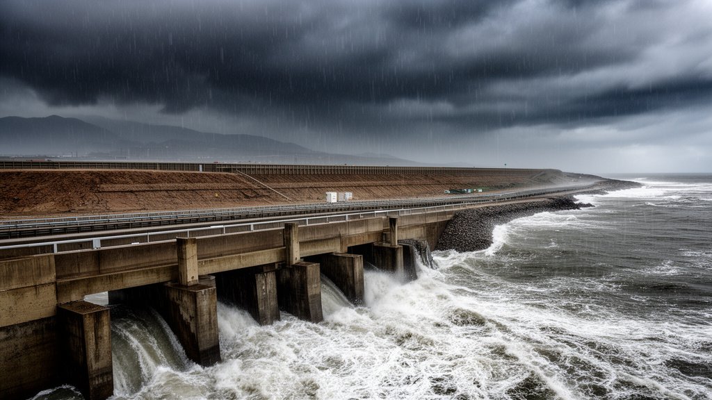
A powerful and strengthening ‘Super El Niño’ weather pattern, fueled by anomalously high sea surface temperatures across the Pacific, is set to drastically alter the climate landscape of the Western United States. Leading climate researchers are sounding the alarm, projecting that the event will drive a notably wet winter season, characterized by an heightened risk of extreme flooding, and potentially maintaining its grip on regional weather systems well into early 2027. The convergence of atmospheric instability and moisture-rich storm tracks has placed emergency management agencies on high alert as they brace for a prolonged period of hydrometeorological volatility.
Key Highlights:
- Super El Niño Intensification: Rising sea surface temperatures are driving the current ‘Super’ status of the El Niño-Southern Oscillation (ENSO), significantly altering Pacific jet streams.
- Severe Flooding Forecast: Models indicate an increased probability of major flooding events across Western coastal regions, driven by intensified atmospheric river activity.
- Multi-Year Duration: Scientists caution that the atmospheric signature of this event may persist into early 2027, challenging long-term infrastructure and agricultural planning.
- Regional Vulnerability: The Western United States faces unique risks as saturated soils from previous winters combine with new precipitation, heightening landslide and flash flood potential.
The Meteorological Drivers of the Super El Niño
The phenomenon known as El Niño is characterized by a significant warming of sea surface temperatures (SSTs) in the central and eastern Pacific Ocean. When these temperatures cross specific thresholds, the event is classified as a ‘Super El Niño,’ a designation indicating that the energy exchange between the ocean and the atmosphere is operating at peak capacity. This shift fundamentally alters the positioning of the subtropical jet stream. By shifting the jet stream further south, the system effectively acts as a conveyor belt for moisture, dragging tropical storms and atmospheric rivers directly into the Western United States, particularly targeting California, Oregon, and Washington.
Understanding Atmospheric River Dynamics
Atmospheric rivers—narrow, concentrated plumes of moisture that transport immense volumes of water vapor—are the primary mechanism for the flooding predicted by climate models. During this Super El Niño event, the thermal gradient between the warming ocean and the cooler continental landmass is expected to sharpen, providing the necessary energy to fuel more frequent and intense atmospheric river landfalls. These events, often referred to as ‘Pineapple Express’ scenarios when the moisture originates near Hawaii, have the potential to drop several months’ worth of precipitation in just a few days, overwhelming local drainage systems and reservoir capacities.
Infrastructure Vulnerabilities and Flood Preparedness
The projected duration of this weather pattern into early 2027 poses a critical challenge for municipal and state infrastructure. Unlike transient storm systems, a sustained meteorological shift requires a multi-year strategy for flood mitigation. Current infrastructure in the Western US, much of which was designed under older climate parameters, may struggle to manage the sheer volume of water predicted. Concerns are mounting regarding the integrity of levees, the capacity of stormwater runoff systems, and the increased risk of catastrophic debris flows in areas previously scorched by wildfires. Localized flood management agencies are currently reviewing evacuation protocols and surge capacity to ensure that rural and urban centers are not caught unprepared by rapid-onset flooding.
Economic and Environmental Cascades
The impact of this climate event extends far beyond the immediate threat of water damage. Agriculture, a cornerstone of the Western economy, faces a complex paradox. While the additional water can replenish essential reservoirs, the timing and intensity of the rain can lead to significant crop loss, erosion, and soil saturation that delays planting seasons. Furthermore, the persistence of these conditions into 2027 suggests a prolonged period of elevated humidity, which can alter local ecosystems, potentially leading to invasive vegetation growth and subsequent fire risks once the dry cycle eventually returns. Researchers from institutions like the National Oceanic and Atmospheric Administration (NOAA) are closely monitoring these secondary environmental indicators to provide localized, actionable intelligence for land managers.
FAQ: People Also Ask
Q: What makes this El Niño ‘Super’ compared to standard cycles?
A: The ‘Super’ designation is based on the magnitude of sea surface temperature anomalies in the Niño 3.4 region. These events represent significant departures from the long-term average, resulting in much stronger coupling between ocean and atmospheric systems compared to moderate El Niño cycles.
Q: How does this impact the 2027 timeline?
A: While the oceanic phase of El Niño may wax and wane, the atmospheric and hydrological response in the Western US can experience ‘lag’ effects. Scientists warn that soil saturation and groundwater level changes could keep the risk of flooding and related geological hazards elevated until the climate system fully stabilizes in early 2027.
Q: Why is flooding a concern if we have been in a drought?
A: While droughts create water deficits, the soil structure becomes hydrophobic (water-repellent) after long dry periods. When extreme rainfall hits, the water runs off the surface rather than soaking in, leading to rapid flash flooding and debris flows regardless of the underlying water deficit.
Q: How can residents prepare for these conditions?
A: Experts recommend clearing local storm drains, reviewing flood insurance policies (as standard homeowners insurance rarely covers flood damage), and preparing emergency kits that include enough supplies to last 72 hours in the event of infrastructure failure or road closures.