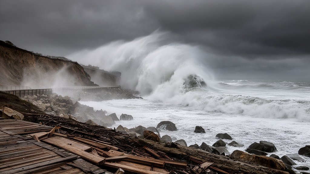
California’s coastal communities are on high alert as a series of intense Pacific storm systems continue to batter the coastline, culminating in record-breaking wave heights that have reached a staggering 34 feet in the Monterey area. This surge represents one of the most significant oceanographic events in recent history, challenging local infrastructure, overwhelming seawalls, and forcing emergency responses across the state. The convergence of high-tide cycles and extreme offshore wind energy has created a “perfect storm” scenario that local authorities are monitoring with extreme caution.
Key Highlights
- Record-Breaking Swells: Wave heights in Monterey have officially been measured at 34 feet, far exceeding typical winter averages and testing the limits of coastal breakwaters.
- Infrastructure Stress: Significant damage has been reported to public coastal infrastructure, including boardwalks, piers, and shoreline access points in multiple counties.
- Power and Connectivity: The relentless storms have compromised utility grids, leading to widespread power outages impacting thousands of residents and disrupting critical coastal services.
- Emergency Response: State and local emergency management agencies are actively managing fallout, with flood warnings and evacuation alerts issued for low-lying coastal zones.
The Pacific Surge: An Unprecedented Coastal Crisis
The current wave event is not an isolated anomaly but the apex of a prolonged atmospheric disturbance. Meteorologists from the National Weather Service (NWS) have identified a consistent “firehose” of moisture-laden air, known as an atmospheric river, that has been feeding the Pacific storm systems for several days. Unlike typical seasonal winter storms, the specific orientation of these systems has maximized the fetch—the distance over which wind blows across the water—allowing for the generation of gargantuan swells that arrive with terrifying energy.
The Physics of the Impact
When waves reach 34 feet, they cease to be merely a coastal aesthetic or a surfing attraction; they become a geological force. The immense kinetic energy dissipated upon impact with the shoreline causes immediate erosion. In Monterey and surrounding regions, the coastal topography—often composed of sensitive bluffs and dunes—is rapidly retreating. The structural integrity of waterfront properties is being scrutinized as the ground beneath foundations is effectively stripped away by backwash. These waves are not just tall; they are powerful enough to move boulders and debris that block vital coastal transport arteries, effectively isolating certain communities until cleanup crews can clear the roadways.
Infrastructure and Utility Collapse
The storm has laid bare the fragility of California’s coastal infrastructure. Many of the state’s historic piers and harbor facilities were not engineered to withstand sustained impact from waves of this magnitude. In Monterey, localized flooding has inundated drainage systems, leading to hazardous standing water on coastal highways. Furthermore, the wind component of these storms has been equally destructive, downing utility poles and lines. Utility providers, such as PG&E, have been working under dangerous conditions to restore power. The synergy of rising tides and failing power infrastructure creates a “cascading failure” environment where communication lines and emergency lighting systems are often the first to go offline.
A Shift in Climatological Trends
While historical data shows that California has always dealt with winter storms, climate researchers are increasingly pointing to a shift in intensity. These “super-swells” are becoming more frequent. The interaction between warmer ocean surface temperatures and a strengthening jet stream means that storms are carrying more moisture and packing more wind energy than in decades past. This suggests that the current state of emergency is a harbinger of a new normal—one that requires a radical rethinking of coastal zoning, the fortification of seawalls, and the long-term viability of beachfront real estate.
Economic and Community Resilience
The economic toll of these events is multifaceted. Beyond the immediate costs of debris removal and power restoration, there is a looming long-term impact on the tourism industry, which serves as the lifeblood of many coastal communities. Business owners in Monterey and Santa Cruz are facing the grim prospect of repeated closures. However, the resilience of these communities is evident in the swift mobilization of local volunteer networks and the rapid response of municipal works departments. State-level resource allocation is being fast-tracked to ensure that small businesses receive the necessary aid to recover, as the state government acknowledges that coastal stability is synonymous with economic stability.
FAQ: People Also Ask
1. What is causing these 34-foot waves in California?
These extreme waves are driven by a combination of a sustained atmospheric river event and high-energy swells generated by intense, long-duration wind patterns across the Pacific Ocean. The alignment of the storm front has optimized wave growth, leading to record-breaking heights upon landfall.
2. Is it safe to go to the beach during these swells?
Absolutely not. Authorities have strictly prohibited beach access in affected areas. The danger includes not just the waves themselves, but the “sneaker waves” that can travel much further inland than expected, as well as the risk of cliff erosion and falling debris.
3. How long will the storm impacts last?
While the most intense period of the surge is centered around this event, the saturation of the ground and the damage to infrastructure mean that the effects will be felt for several weeks. Ongoing monitoring by the NWS is essential, as saturated bluffs remain susceptible to landslides even after the waves subside.
4. What should coastal residents do to prepare?
Residents should monitor NWS alerts, secure loose outdoor objects, prepare for potential power outages, and have a “go-bag” ready in case local authorities mandate evacuations due to rising water or coastal instability.