The National Weather Service (NWS) has issued an urgent Red Flag Warning for the Palo Alto foothills and the greater Santa Cruz Mountains, effective for August 28, 2026. This warning underscores a precarious meteorological window characterized by the volatile combination of dry lightning strikes and gusty, erratic winds, creating an environment where fire starts can transition rapidly into uncontrollable wildfire events.
Key Highlights
- Critical Timing: The Red Flag Warning is active throughout August 28, 2026, covering the Palo Alto foothills and the Santa Cruz Mountains.
- Primary Hazards: A convergence of high-altitude instability, potential lightning strikes, and high-velocity wind gusts.
- Safety Protocol: Residents are urged to prepare “go-bags,” secure loose outdoor items, and monitor emergency channels for potential evacuation notices.
- Infrastructure Alert: Utility providers are monitoring the grid for potential “Public Safety Power Shutoffs” (PSPS) to mitigate ignition risks.
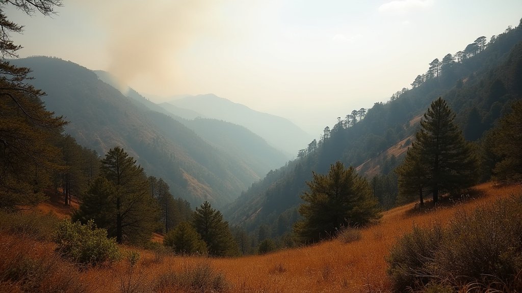
- Geographic Sensitivity: The rugged terrain of the Santa Cruz Mountains remains high-risk due to dense, dry fuel loads and challenging access for first responders.
Understanding the Atmospheric Volatility
The meteorology driving the August 28, 2026 event is a classic, high-risk pattern for Northern California. A Red Flag Warning is the highest level of alert issued by the National Weather Service, signaling that the intersection of humidity, wind, and dry fuel has created “extreme fire behavior.” In the Santa Cruz Mountains, this warning is particularly concerning because the topography—steep canyons and ridges—acts as a chimney for wind-driven fires.
The Dry Lightning Factor
One of the most dangerous aspects of this specific weather system is the risk of “dry lightning.” Unlike standard thunderstorms, these events often occur with minimal precipitation. Lightning strikes occurring in this arid atmosphere often ignite dry brush and timber before any moisture can reach the ground to suppress the spark. Historical data, including the devastating 2020 CZU Lightning Complex fires, demonstrates that a single lightning event in this region can trigger dozens of simultaneous starts, severely overstretching the resources of organizations like Cal Fire and local municipal departments.
Impact on Palo Alto Foothills
The foothills of Palo Alto are a unique urban-wildland interface. As residential developments push into the lower elevations of the Santa Cruz range, the risk to property and infrastructure increases exponentially. The combination of high-density housing and surrounding flammable chaparral vegetation makes any ignition source a significant threat to life and property. Local emergency management teams have increased patrols and are advising residents to clear defensible space around their homes immediately, as “ember casting”—where burning material is lofted by wind into residential areas—is a primary concern during high-wind events.
The Role of Topography and Wind
Wind behavior in the Santa Cruz Mountains is notoriously unpredictable. During a Red Flag event, “diurnal winds”—the movement of air between mountains and valleys—can amplify in speed as they funnel through narrow passes. These gusts can turn a small, smoldering ignition into a rapid, wind-driven fire front in minutes. The NWS warning explicitly highlights the risk of these “downslope winds,” which can drive heat towards populated foothill areas.
Secondary Angles: Why This Matters
1. The Utility Grid and PSPS Protocols
The risk of wildfires has fundamentally changed how electrical utilities operate in California. During Red Flag conditions, PG&E and other providers often implement Public Safety Power Shutoffs (PSPS). While these shutoffs are intended to prevent equipment-related ignitions (like a downed wire sparking a blaze), they introduce their own set of economic and social challenges. Businesses in the Palo Alto foothills must balance the need for operational continuity with the mandate to safely de-energize circuits, highlighting the tension between energy reliability and public safety.
2. The Shifting Insurance Landscape
Beyond immediate safety, events like the August 28 warning are part of a long-term trend influencing the insurance market. Residents in high-fire-severity zones are increasingly facing “non-renewals” or skyrocketing premiums. The frequency of Red Flag Warnings is becoming a metric used by actuaries to assess risk, turning “fire weather” into a structural economic force that is slowly reshaping real estate valuations in the Palo Alto foothills.
3. Long-term Climate Adaptation
This event is not isolated; it is symptomatic of a broader shift in the regional climate. Increased heat and prolonged dry periods have extended the fire season in Northern California. Long-term planning, such as “prescribed burns” and “mechanical thinning” of forest undergrowth, is becoming the focal point of wildfire mitigation. This Red Flag Warning highlights the urgency of transitioning from reactive emergency responses to proactive, year-round land management strategies.
FAQ: People Also Ask
Q: What is the difference between a Fire Weather Watch and a Red Flag Warning?
A: A Fire Weather Watch is issued when the potential for dangerous fire conditions exists. A Red Flag Warning is issued when those conditions are already occurring or will occur within 24 hours, demanding immediate action.
Q: Should I evacuate now?
A: Not unless you receive an official order from local authorities. However, you should prepare your “Go-Bag” and have a plan in place. Follow the Palo Alto Fire Department and Santa Cruz County emergency alerts for real-time status updates.
Q: Why does the Santa Cruz region get so many Red Flag Warnings?
A: The region’s combination of steep, rugged terrain, seasonal drying of vegetation (fuel), and specific offshore wind patterns makes it naturally susceptible to the precise weather combinations that define a Red Flag event.
Q: How does lightning cause wildfires if there is no rain?
A: Lightning acts as a high-heat ignition source. If the ground fuels (grass, pine needles, dead brush) are dry enough, the heat from the lightning strike creates a “spot fire” immediately. Without rain to dampen the fuel, the fire can spread rapidly, driven by the winds that typically accompany these storm systems.