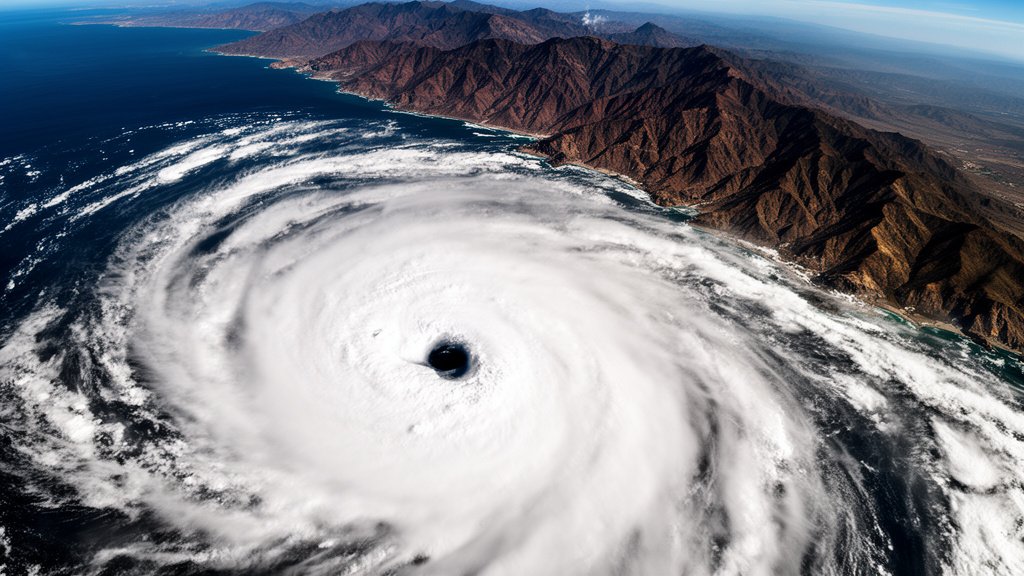
Hurricane Simon has escalated into a major meteorological event, officially reaching Category 4 status on the Saffir-Simpson Hurricane Wind Scale. The storm, which is currently churning off the Pacific coast of Mexico, is packing sustained winds of 150 mph, making it a life-threatening system. Meteorologists and local authorities in Southwestern Mexico are urging residents to prepare for extreme flooding, powerful storm surges, and the significant risk of mudslides as the cyclone tracks closer to the mainland, with Manzanillo remaining a focal point for potential landfall impact.
Key Highlights
- Maximum Intensity: Hurricane Simon has reached Category 4 status, sustaining winds of 150 mph, designating it a major, dangerous hurricane.
- Primary Threat Zones: Southwestern Mexico, including coastal regions near Manzanillo, face the highest risk of catastrophic flooding and destructive wind gusts.
- Emergency Protocols: Local government agencies and CONAGUA (National Water Commission) have escalated emergency warnings, advising immediate evacuation and secure sheltering for residents in low-lying areas.
- Environmental Hazards: Authorities are highlighting the high probability of mudslides, particularly in mountainous coastal terrain, and dangerous storm surges that could submerge vulnerable infrastructure.
The Atmospheric Power and Path of Hurricane Simon
The rapid intensification of Hurricane Simon into a Category 4 system marks a significant escalation in the ongoing Pacific hurricane season. According to data provided by the National Hurricane Center (NHC), the storm’s central pressure has plummeted as it pulls energy from the warm waters of the Pacific Ocean. This thermodynamic fueling is a primary driver behind the sustained 150 mph winds, creating a tightly wound, high-energy vortex that presents a severe danger to navigation and coastal stability.
Dynamics of Rapid Intensification
Meteorologists are closely monitoring the mechanisms fueling Simon’s growth. Rapid intensification—defined as a 35 mph increase in wind speed within 24 hours—has characterized this storm’s recent trajectory. The moisture-rich environment and low vertical wind shear in this sector of the Pacific have allowed the storm to maintain its structural integrity and grow in size. This intensification phase is critical, as it limits the lead time for emergency responders to coordinate with coastal communities that are directly in the storm’s projected path. The structural complexity of a Category 4 storm implies that the damage radius extends well beyond the eye, with hurricane-force winds impacting a wide swath of the coastline.
Geography and Coastal Vulnerability
Southwestern Mexico, characterized by its rugged mountainous terrain meeting the Pacific, is particularly vulnerable to the secondary effects of such a system. While wind damage is immediate, the secondary threat of torrential rainfall causing massive mudslides is perhaps the most dangerous variable for inland communities. The steep topography of the region exacerbates the velocity of water runoff, meaning that communities miles away from the coastline are still at high risk. Municipalities near Manzanillo are on high alert, with emergency teams conducting pre-emptive assessments of drainage infrastructure, which is expected to be overwhelmed by the projected rainfall totals.
Emergency Management and Strategic Preparedness
Federal and local authorities, including Mexico’s civil protection agencies, have mobilized to establish temporary shelters and secure critical infrastructure. The government has prioritized the safety of residents in vulnerable informal settlements, where housing structures may not meet the safety requirements to withstand Category 4 wind loads. Logistics experts are warning that as the storm makes its final approach, transportation networks—including highways and port facilities—may become impassable. The emphasis is on immediate evacuation for those in high-risk zones, as the ‘window of safety’ closes rapidly when the storm transitions from a tropical system to a landfalling hurricane.
Economic and Infrastructure Impact
Beyond the immediate threat to life, Hurricane Simon poses a substantial economic challenge. The region’s tourism and commercial fishing industries are vital to the local economy and face the prospect of widespread disruption. Port operations, particularly in major hubs like Manzanillo, face the potential for multi-day shutdowns, which can create ripples in regional supply chains. Insurance adjusters and government planners are already looking ahead to the massive task of post-storm reconstruction, acknowledging that the financial toll of a direct Category 4 hit can take years to mitigate.
Meteorological Forecasting and Future Climate Context
Looking at the broader context, Hurricane Simon serves as a stark reminder of the volatility of Pacific cyclonic activity. Climate scientists observing these trends often point to rising sea surface temperatures as a contributing factor to the frequency of high-intensity storms. By analyzing historical data from past decades, experts have noted that while the Pacific is no stranger to hurricanes, the ‘power ceiling’—how strong these storms can get—appears to be trending upward. Understanding these patterns is essential for future urban planning, as coastal regions must now design and build to withstand higher wind intensities and more significant flooding events than were previously considered the ‘norm’ for this region.
FAQ: People Also Ask
What makes a Category 4 hurricane particularly dangerous?
A Category 4 hurricane is defined by winds between 130 and 156 mph. At this level, catastrophic damage is expected. Well-built homes may lose roof structures or exterior walls, trees will be snapped or uprooted, and electricity and water may be unavailable for days or weeks after the storm.
How should residents prepare for a storm like Hurricane Simon?
Residents should prioritize securing their homes, clearing debris from property that could become projectiles, and assembling a ‘go-bag’ with essential documents, medication, and three days of water and non-perishable food. It is vital to follow all evacuation orders issued by local authorities immediately.
What is the difference between a hurricane watch and a warning?
A hurricane watch means that hurricane conditions are possible within the specified area, usually within 48 hours. A hurricane warning means that hurricane conditions are expected, and preparations should be rushed to completion immediately, as the window for safety is closing.
How does coastal terrain affect hurricane impact?
In regions like Southwestern Mexico, steep, mountainous terrain can lead to heavy orographic rainfall. This significantly increases the risk of mudslides and flash flooding, often extending the life-threatening impact of the storm well beyond the immediate coastal areas.