A significant winter storm is unleashing its fury. It targets the Sierra Nevada region. Powerful Pacific storms are bringing heavy snowfall. The storm is expected to last through February 18, 2026. Forecasters predict up to 2.4 meters (8 feet) of snow. This is for higher elevations. Snowfall rates could exceed 76 mm (3 inches) per hour. Travel conditions will become dangerous. In fact, they may become impossible. This news impacts the West Coast.
Forecast Details and Timing
The National Weather Service (NWS) has issued urgent warnings. A Winter Storm Warning is in effect for much of the Sierra Nevada. It spans from Sunday, February 15, through Wednesday, February 18, 2026. Some forecasts indicate storm activity continuing into the following week. The storm system is a two-part event. The first wave hit Sunday night into Monday. The second, colder wave arrives Tuesday. This second pulse could bring heavier snow.
Snowfall Accumulations
Higher elevations will receive the most snow. Ski resorts along the crest could get 5 to 7 feet. Peaks might see even more. Donner Summit could receive up to 4 feet. Other areas like Palisades Tahoe and Sugar Bowl expect over 60 inches. Areas above 6,000 feet may accumulate 3 to 5 feet. Some highest elevations could get 5 to 7 feet. Below 4,000 feet, 1 to 2 feet of snow is possible. Snow levels will drop significantly. They will start around 5,000-6,000 feet. By Tuesday, levels could reach 2,000 feet or even lower. This means snow could affect foothills and lower valleys.
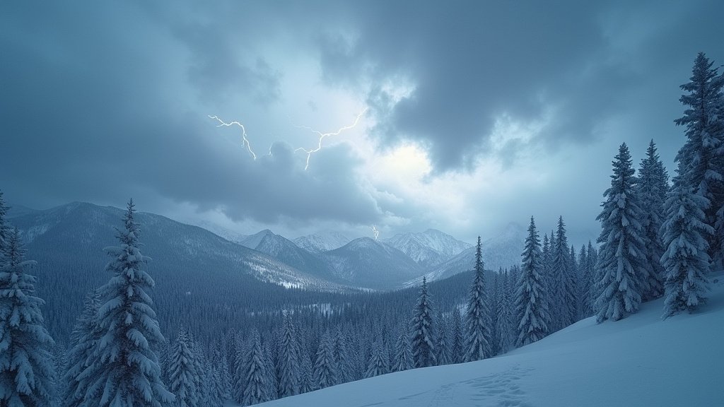
Hazardous Conditions and Travel Impacts
Dangerous conditions are expected. Wind gusts will be fierce. Gusts could reach 100 mph along Sierra ridges. Valleys might see 35 to 45 mph gusts. These winds combine with heavy snow. Consequently, whiteout conditions are likely. Visibility may drop to near zero. Travel will be extremely difficult. Indeed, it could be impossible.
Caltrans is alerting motorists. They urge people to avoid travel. If travel is necessary, expect delays. Chain controls are mandatory. Interstates like I-80 are already under chain controls. Some roads, like Topanga Canyon Boulevard, are closed. Major highways could face lengthy closures. This includes Interstate 80 over Donner Summit. Bus services have been canceled. This significantly impacts holiday travel. Millions of dollars in tourism revenue could be affected.
Broader Implications
This storm is a welcome change. California has experienced a dry spell. The snowpack is crucial. It replenishes the state’s water reserves. However, the heavy rain brings risks. Flash flooding is a major concern. Landslides and mudslides are also possible. Evacuation warnings are issued for burn scar areas. These include the Palisades and Eaton burn areas. The storm also brings a severe weather threat. Waterspouts and weak tornadoes are possible. This is especially true in the LA Basin.
Safety and Preparation
Authorities advise preparedness. Motorists should check forecasts. They must carry chains. Ensure vehicles have full fuel tanks. Pack extra supplies. This includes water, blankets, and flashlights. Traveling on Tuesday might offer a better window. This allows plows time to clear roads. Drivers must exercise extreme caution. Speed is the enemy on icy roads. Patches of ice can be invisible. This storm is a powerful reminder. Winter is far from over. It highlights the importance of staying informed.